Free Online Map Viewer & Geospatial Data Visualizer
DudeMap is a fast and modern online map viewer.
Upload geospatial files — GeoJSON, Shapefile, FlatGeobuf, KML, GPX, CSV — and view them instantly
on an interactive map.
No installation. No signup. Just upload and explore.
Supported Map & Geospatial Formats
GeoJSON (.geojson)
Shapefile (.shp inside .zip)
FlatGeobuf (.fgb)
KML / KMZ
GPX
CSV (lat/lng)
WKT / WKB (coming soon)
Features
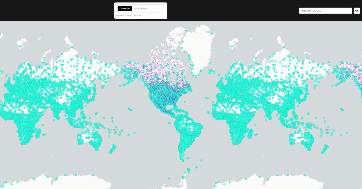
Instant rendering of polygons, lines, and points
Interactive base maps powered by MapLibre & deck.gl
Attribute table viewer (coming soon)
Spatial tools: buffer, nearest point, measure distance
Coordinate conversion (EPSG:3857 ↔ EPSG:4326)
Export processed data to GeoJSON
Why People Use DudeMap
Simple for beginners. Powerful for pros.
A clean, fast, web-based map viewer you can access from any device.
Explore Your Data in 3D & Find Any Place Instantly
DudeMap offers an advanced three-dimensional map experience where you can tilt, rotate, and
navigate through cities rendered with extruded structures and terrain-style visuals.
Whether you're examining detailed GeoJSON layers in 3D or browsing Shapefiles, FlatGeobuf, or
other geospatial formats, the MapLibre rendering engine provides smooth and realistic interaction.
For even richer visualization, DudeMap integrates Deck.gl, enabling high-performance,
GPU-accelerated
rendering of massive geospatial datasets. This makes it possible to visualize millions of points, heatmaps, 3D arcs,
and advanced layers with exceptional clarity and speed.
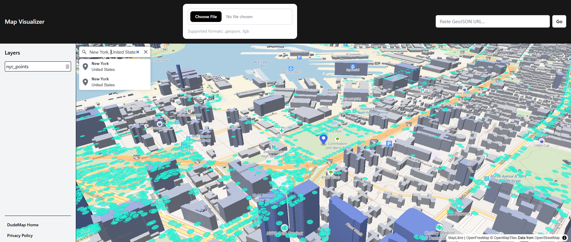
The platform also includes a powerful global place search tool. Enter any address, landmark, or
coordinate, and the map instantly zooms and orients itself to that location. This makes it easy to connect your
uploaded datasets with real-world places for planning, research, and mapping workflows.
Highlights of the 3D GeoJSON Viewer, Deck.gl & Search Tools
Search cities, addresses, and landmarks using the built-in geocoding engine
Render polygons, lines, and points in a fully interactive 3D scene
Visualize millions of features using Deck.gl's GPU-powered layers
Create advanced effects like heatmaps, cluster maps, 3D arcs, and path layers
Overlay search results on top of your GeoJSON, Shapefile, FGB, KML, GPX, or CSV data
Move through the map with fluid tilt, pitch, and rotation controls
Use DudeMap as a 3D GIS viewer directly in the browser—no installation needed
Instantly focus the map on searched locations, coordinates, or dataset features
DudeMap brings together 3D geospatial visualization, Deck.gl high-performance
rendering,
and instant global search, creating a versatile online mapping environment suitable for urban
studies,
GIS analysis, field planning, environmental work, and interactive map exploration.
Featured Map Datasets
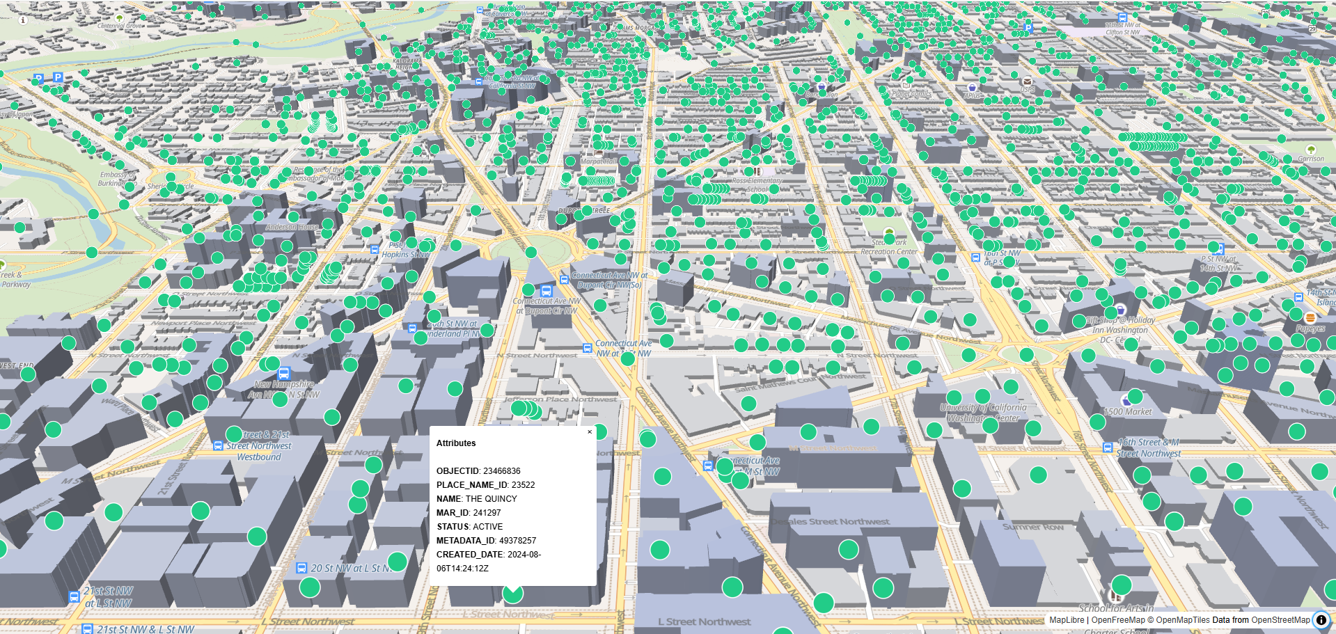
Points of Interest (POI) Dataset - Washington, D.C., USA
Explore and visualize key locations in DC in 3D on interactive maps. Contains address alias
points including Schools, Hospitals, Monuments, and more.
This dataset provides geocoded locations and attributes of address alias points, created as part of the
Master Address Repository (MAR) for the Office of the Chief Technology Officer (OCTO) and participating DC
government agencies.
You can visualize your data in 3D to see Schools, Federal Buildings, Military
Installations, Hospitals, Museums, Monuments, University Structures, Fire and Police Stations, Libraries,
Metro Facilities, Historical Landmarks, Recreation Centers, Mile Markers, and Marinas.
Schools
Federal Buildings
Military Installations
Hospitals
Museums
Monuments
University Structures
Fire and Police Stations
Libraries
Metro Facilities
Historical Landmarks
Recreation Centers
Mile Markers
Marinas
Visualize in 3D: Import this GeoJSON into your interactive 3D mapping application (MapLibre
GL, Mapbox, or Cesium) for immersive spatial analysis and urban planning.
More information:
opendata.dc.gov
|
Data dictionary:
here.
MAR 2 uses PLACE_NAMES_PT with additional info like created/edited dates.
Dataset provided by the DC Office of the Chief Technology Officer (OCTO), available via
opendata.dc.gov.
Licensed under CC BY
4.0.
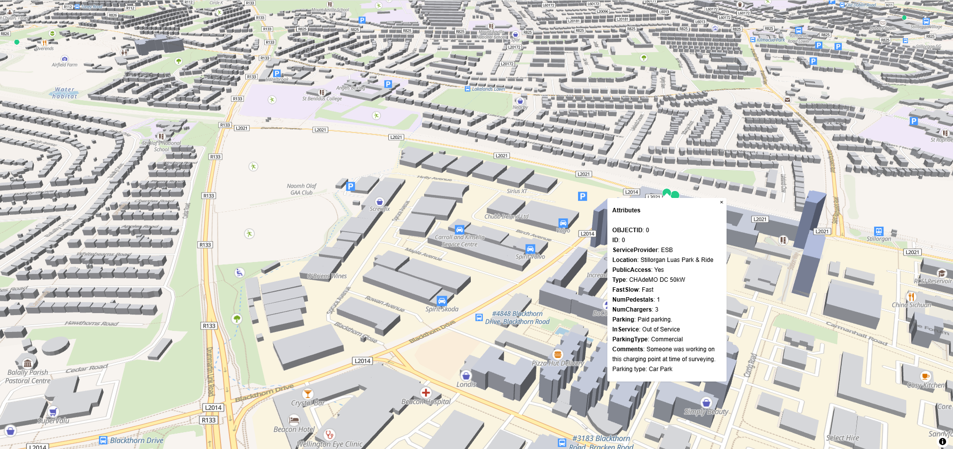
EV Charging Points - Dún Laoghaire-Rathdown County, Ireland
Explore and visualize Electric Vehicle (EV) charging points in DLR County in 3D on interactive
maps. Includes geospatial coordinates and key attributes for each charging station.
This dataset provides locations of EV charging points across Dún Laoghaire-Rathdown (DLR) County. Data was
collected by Compass in a 2019 survey and may not include newly installed points. Some
charging stations may be on private property or restricted to certain customers.
Use Cases: 3D GIS visualization, interactive mapping, EV infrastructure planning, urban
planning, and public awareness of charging locations.
Visualize in 3D: Import this GeoJSON into MapLibre GL, Mapbox, Cesium, or other 3D mapping
platforms to see EV charging points in context and perform spatial analysis.
Dataset Attribution: Published by Dún Laoghaire-Rathdown County Council.
Original dataset available at
data.smartdublin.ie
and listed on
data.europa.eu
. Created: 13 May 2025 | Updated: 26 May 2025.